Unlock Insights with Precision Aerial Imaging & Geospatial Data
Successful aerial data and footage acquisition demands more than just capable aircraft; it requires meticulous mission planning, seamless sensor integration, and expert navigation of regulatory approvals. Helicopters Over Sacramento streamlines this entire process, serving as your primary mission command center. We precisely assess your specific data or footage requirements for projects in Sacramento or the surrounding regions, recommend the optimal airframe and specialized flight crew for your profile, and manage all necessary flight planning and permits. This integrated approach provides you with a single point of accountability and a truly turnkey solution, ensuring your complex aerial missions are executed flawlessly and efficiently.
Cinema & Broadcast Videography
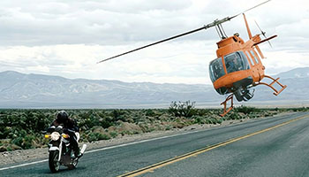
For Directors of Photography and production teams across California, we provide the exceptionally stable, high-performance aerial platforms essential for feature films, commercials, and live broadcast events. We fully support industry-standard stabilization systems, including Shotover, Cineflex, and Tyler Mounts, ensuring your equipment integrates seamlessly. Our operations coordinate expertly with your production crew to achieve perfect shot execution, delivering the dynamic, high-quality footage your project demands without compromise or delay.
Aerial Photography
Elevate your visual assets with breathtaking, high-resolution aerial photography. We capture stunning marketing materials, compelling real estate portfolios across the Sacramento Valley, and precise progress documentation. Our experienced teams possess a deep understanding of optimal lighting, angles, and composition, consistently delivering magazine-quality stills that professionally enhance your brand and projects.
LiDAR & Geospatial Surveying
Unlock critical insights with data extending beyond the visible spectrum. We facilitate LiDAR acquisitions, orthomosaic mapping, and 3D terrain modeling, providing essential support for advanced urban planning, comprehensive utility inspections across Sacramento, and detailed environmental monitoring initiatives.
Utility & Asset Inspection
Achieve rapid, detailed inspections of vital infrastructure like transmission lines, pipelines, and cell towers. Our helicopter services offer the stable hover and flight precision necessary for high-fidelity asset auditing, ensuring thorough data collection for your projects.
Technical FAQ
Our platforms are expertly configured to accommodate all major industry mounts, including Shotover (F1, K1), Cineflex, and Wescam, providing unmatched versatility. For productions utilizing lighter cinema payloads, we readily support Tyler Minigyro and Middle mounts, ensuring your creative vision is realized.
Absolutely. We manage all necessary airspace authorizations and flight plans for urban operations throughout Sacramento and surrounding areas. Our aviation professionals are highly experienced in navigating complex controlled airspace, ensuring your aerial photography or videography needs are met legally and safely, without compromising your project timeline.
We provide a flexible, turnkey solution, whether you require a specialized sensor operator from our team or prefer to fly your own creative crew. Should you bring your team, we ensure comprehensive safety briefings and clear air-to-ground coordination protocols are established, guaranteeing a smooth and secure operation for your project.
Depending on your specific sensor payload, we deliver essential data formats such as raw point clouds (LAS/LAZ), high-resolution orthomosaic maps (TIFF/ECW), or processed 3D meshes. We collaborate closely with your GIS team to guarantee seamless file compatibility and integration into your existing workflows.
Gallery
Aerial Photography
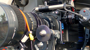
Camera Equipment
Camera Mounts

Damage Survey

Real Estate Survey

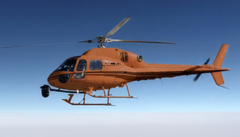
Aerial Videography
Your Complete Aerial Photography and Videography Solutions in Sacramento
Contact Helicopters Over Sacramento today at 1-855-445-8965 for a prompt, no-obligation quote on helicopter aerial photography services across Sacramento and the Central Valley. We are ready to assist with your project.